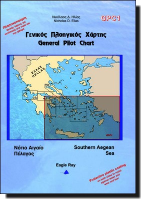
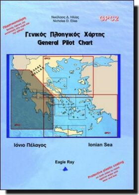
South Aegean Sea General Pilot Chart Eagle Ray GPC1

30,00 

Acheter maintenant
SKU: GPC1
Marque :

Détails Produit

Un bon compromis pour préparer sa croisière :

  • Une carte marine au 1 / 553 000ème
  • un tableau de prévisions météo suivant les infos de baromètre et thermomètre.
  • infos de vents et courants

Informations en Grecque et Anglais
Format Plié : 17×24.5cm
Format ouvert : 100x70cm
Papier imperméable

Retour en haut de page
25
    25
    Votre Panier
    IMRAY_M17 North Tuscan Islands to Rome
    IMRAY_M17 North Tuscan Islands to Rome
    1 X 31,50  = 31,50 
    Shom 7140L Passes et Rade de Lorient
    Shom 7140L Passes et Rade de Lorient
    1 X 37,05  = 37,05 
    Shom 7425L Embouchure de la Gironde
    Shom 7425L Embouchure de la Gironde
    1 X 37,05  = 37,05 
    EN FAMILLE SUR L'ATLANTIQUE
    EN FAMILLE SUR L'ATLANTIQUE
    1 X 29,00  = 29,00 
    Shom 7246 Polynésie française
    Shom 7246 Polynésie française
    1 X 37,05  = 37,05 
    Brazil Cruising Guide Imray de Michel Balette
    Brazil Cruising Guide Imray de Michel Balette
    1 X 65,00  = 65,00 
    Compas droit
    Compas droit
    1 X 22,00  = 22,00 
    C1 Thames Estuary
    C1 Thames Estuary
    1 X 38,00  = 38,00 
    Texte indicatif
    KART 521 Femtebreen - Gråhuken
    1 X 48,00  = 48,00 
    777 GUIDE NAUTIQUE SICILE COTE NORD EST
    777 GUIDE NAUTIQUE SICILE COTE NORD EST
    1 X 29,90  = 29,90 
    Shom 7423L Raz de Sein
    Shom 7423L Raz de Sein
    1 X 37,05  = 37,05 
    Cap Utopia, de Jean-François Diné
    Cap Utopia, de Jean-François Diné
    1 X 20,00  = 20,00 
    Shom 5339 De Majunga à Nossi-Bé
    Shom 5339 De Majunga à Nossi-Bé
    1 X 37,05  = 37,05 
    IMRAY_M16 Ligurian Sea
    IMRAY_M16 Ligurian Sea
    1 X 31,50  = 31,50 
    Le produit a été ajouté à votre panier